Ford Ranger
Naauwpoort 4x4 Trail
I found this trail totally by accident when we popped into the Ohrigstad Dam Nature Reserve. The person at the gate told us about it when we were querying about the reserve. They have absolutely no documentation about anything in the reserve at the gate/office. However, he did say that the trail was quite easy, so I decided to give it a go, even though I would be going in blind.
For those that may be interested, I did some looking into the trail once I was back home. There are almost no references to the trail on google, so I thought I'd share what I had found/experienced.
From the relevant South African 1:50 000 map for the area, which I had downloaded from Spatial Reference, I was able to find the track we had travelled on.
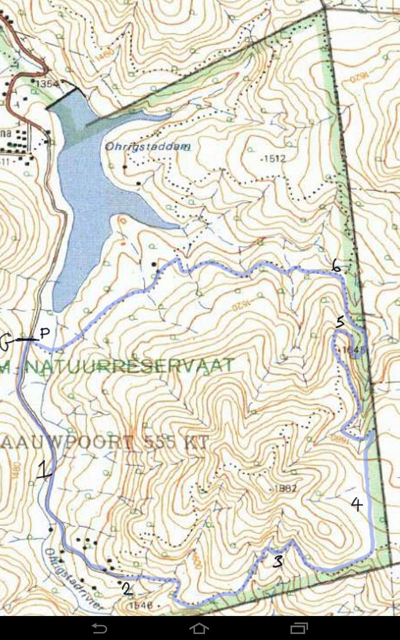
A section of the 1:50 000 map 2430DC (Ohrigstad) showing the Ohrigstad Dam Nature Reserve
I marked the trail we took in blue (discussed below). I also found the trail on the web-based maps on the Tracks 4 Africa website.
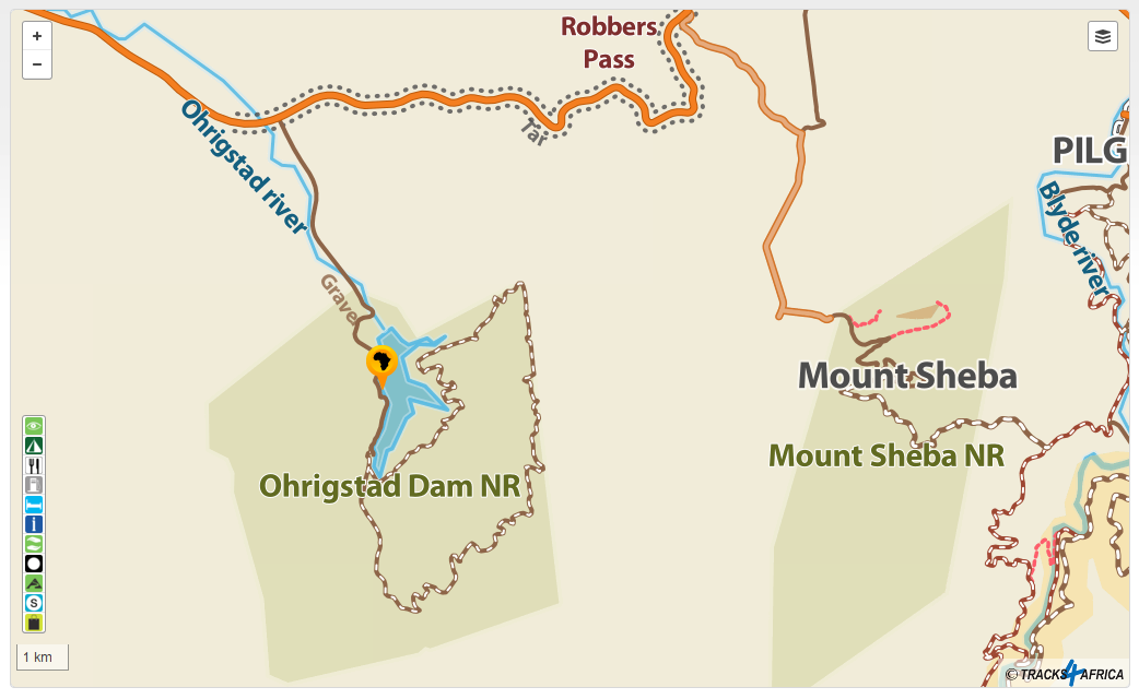
The Ohrigstad Dam Nature Reserve and Mount Sheba Forest Reserve
From the annotations on the 1:50 000 map:
P: Picnic site. The road to the trail is not signposted, but it goes around the western side of the picnic site;
G: The gate to the trail. There is only one key to the gate, so only one group can be on the trail at a time;
1: The start is very easy, except somewhere around where the 1 is placed, where there is a rather tricky mud patch which caught me unawares and I almost slipped off the track;
2: A fairly easy climb up to the split in the track (which required a bit of low range because of the loose stones). The split in the track is quite tricky, especially in a long wheelbase vehicle like the Ranger, as the track does a rather nasty switchback. I decided to carry on straight (remember, I have no maps, and all the track signs look as though they were removed a long time ago). From the maps, and especially the contour lines, it looks as though the other track is the one that would be preferred by hardened 4x4 enthusiasts;
3: A fairly difficult section through the gullies, with shale/slate steps on the climb up (first gear low range);
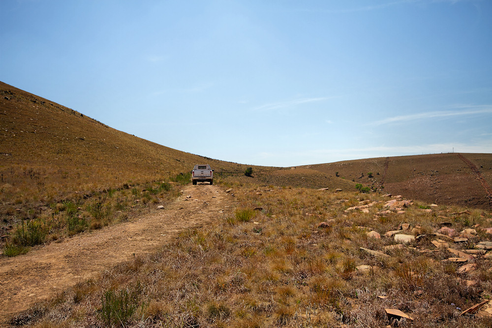
4: A "new" road joining the two trails which was very easy (third gear high range);
5: The most difficult part of the track for me, the climb down the mountain, with three or four switchbacks. I had to get on one of them to check my driving line because of the erosion, the sharpness of the bend (a SWB vehicle should have no problems) and I couldn't see around the corner (first gear low range)
6: The split in the track to the northern half of the trail, I felt like a beer so decided to head back (last part of the trail mixed 4H and 4L).
The overall trip length on the trail I did is around 10km, and it took about 2 hrs to complete. I did stop a couple of times to take pics, but not nearly enough, due to the concentration required to negotiate the trail.
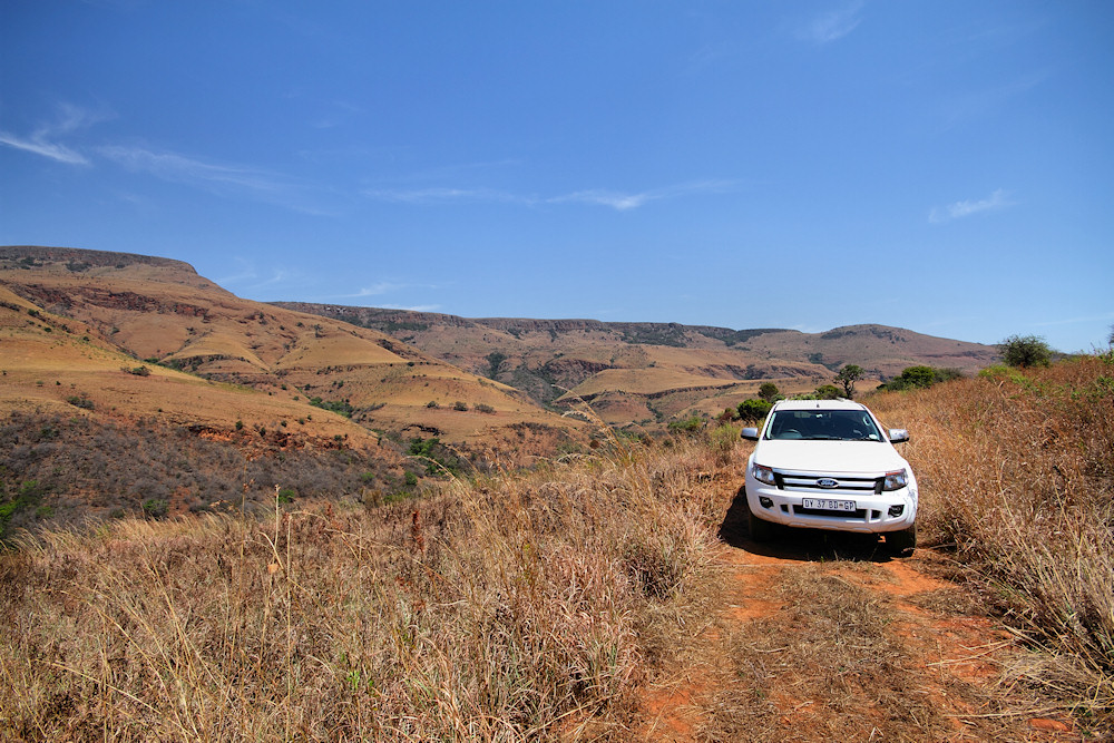
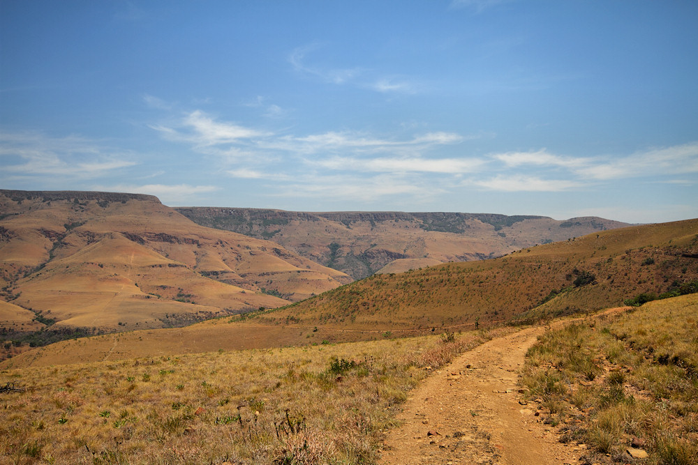
A view from the trail just before point 2 (sorry about the lens distortion!)
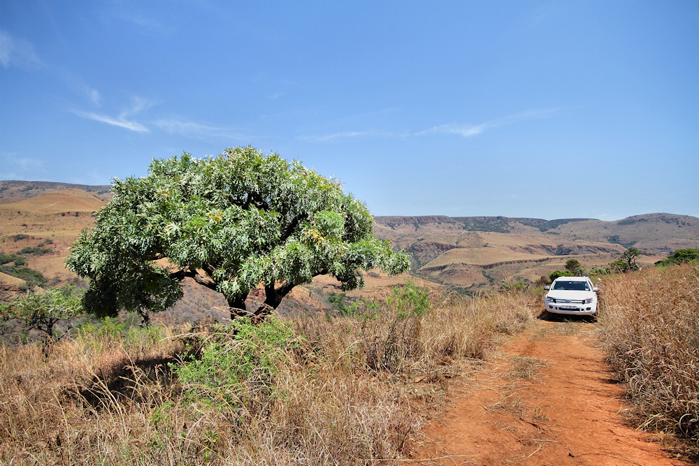
Another view from the same spot
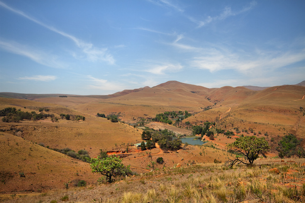
A view of a small resort to the south of the reserve, taken from somewhere between points 3 and 4
A view from the same spot showing the trail climbing up from the fork at point 2 in the distance
Another view from the same spot showing the trail just before the turn to point 4
This trail would be quite dangerous in the wet, especially the section through the slate/shale steps around point 3. In the dry, it would be a very good learning experience for a newcomer to 4x4 trails.
The cost is R170/vehicle for the trail, plus R30/head and R20/vehicle entry fee to the reserve. (12 October 2016)
Back to the bakkie's story.
