Travel - Bontle Rest Camp
Bontle Rest Camp (Marakele National Park)
Introduction
Marakele National Park [coordinates: -24.5308, 27.4978] is a small game reserve north east of Thabazimbi, 256km from my home. The campground in the reserve is called Bontle. There are no chalets, but there are several fully furnished permanent tents available in the Bontle Rest Camp.
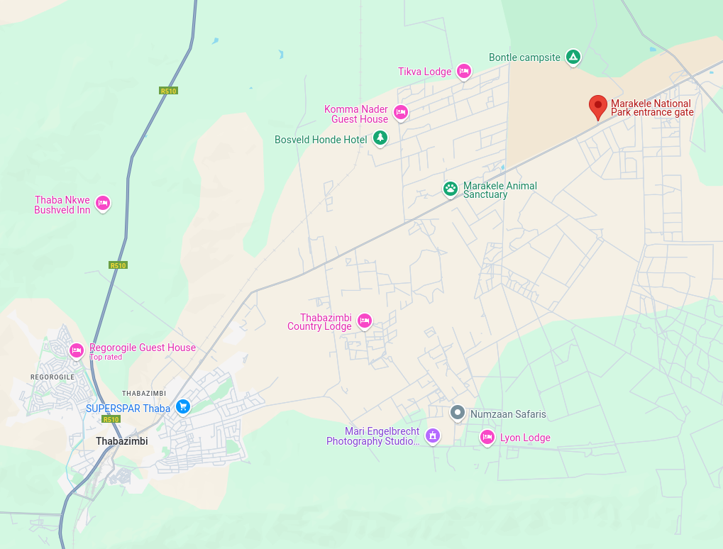
Map 1a: Showing the entrance to Marakele relative to Thabazimbi
Waze will guide you all the way to the gate, but be aware that the roads in and around Warm Baths (Bela Bela) are in a very poor condition. Road markings are virtually non-existant in the town.
Bookings can be done online through the SANparks website linked above. Conservation fees and a community tax can be paid while making the onlne booking.
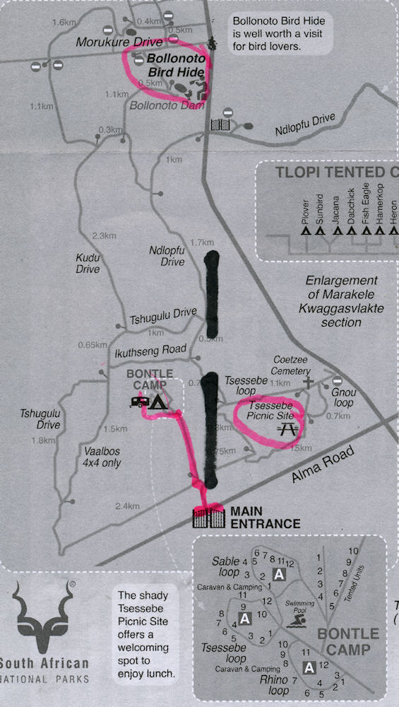
Marakele is spilt into two sections by the Rooiberg road (the map was downloaded from the SANParks website on 10 February 2025).
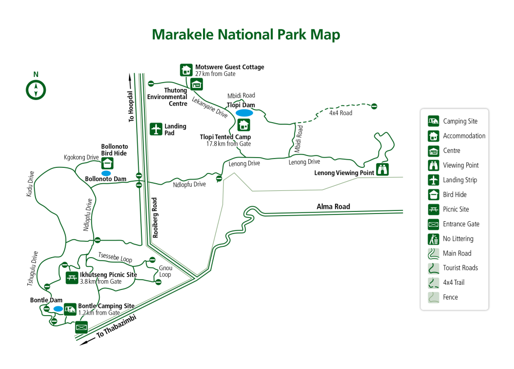
Map 1b: Showing the Rooiberg road splitting the reserve in two
The western section containing Bontle Rest Camp, does not contain any "dangerous" game (although I did hear a hyena barking very close to the campground on our final night). The east and west sections are linked by a tunnel under the Rooiberg road. An electric gate provides access between the two sections.
Some useless info In the 80s, we hiked in this area before it was proclaimed as a game reserve. We started on a farm on the Rooiberg road and ended on a farm on the Alma road, overnighting in Matlabas Zyn Kloof. All that I remember was that the second day was very tough as we had to hike over the ridge running west from Lenong towards the Rooiberg road.
(updated: 12 February 2025)
Campsites
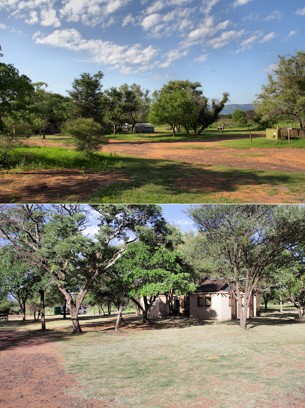
The campground has three ablution blocks, each servicing 12 to 16 campsites. The campground is not fenced, but surrounded by low concrete poles through which the game can freely wander (there is no dangerous game in the western part of the reserve).
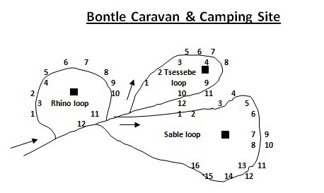
Map 2: Showing the layout of Bontle Rest Camp
On the map above (downloaded from the SANParks website on 10 February 2025), N is roughly in the bottom right corner!! We camped somewhere in the vicinity of campsite 4 on the Tsessebe Loop.

A view towards Bontle Dam showing the concrete poles surrounding the campground
Campsites were not allocated during our stay, but there were only three other campsites occupied when we arrived. I am not too sure how full the campgound gets over weekends and school holidays, so this could be an issue. Campsites are roughly marked by the presence of a braai. Scattered around the loops in the campground are concrete stands with a tap, a bin and two standard three pin electrical power points (these are definitely not outdoor power points, so be wary of using them in the rain).
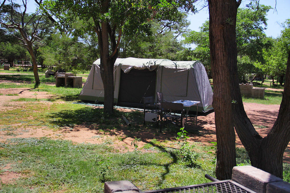
Our campsite
Our campsite, showing the position of a few braais in the vicinity.
There is a fair amount of shade in the campground, with patches of grass. The spot we chose gave the tent shade for most of the day.
A couple of pictures taken on the Rhino loop.
Some of our neighbours with the Rhino Loop ablution block in the bottom pic
There are a few permanent tents on the Tsessebe and Sable Loops. These are fully furnished with a kitchen and a bathroom.
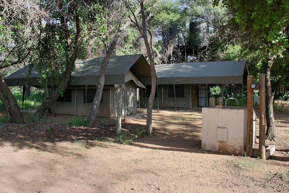
Permanent tents
The ablution block on the Tsessebe loop
Outside the male ablution block are two sinks for dish washing. Outside the ladies section is a tub for clothes washing (which could be used for dishes), and a table top which can be used for ironing or food preparation.
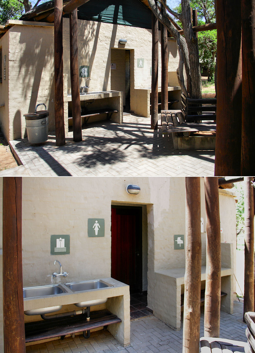
The scullery area, outside the male ablutions (top) and the washing/ironing area outside the female ablutions (bottom)
The male and female ablution blocks each have a shower and a toilet as well as a shower and a toilet for handicapped individuals. The male area also has a urinal.
The bathrooms were clean (they were cleaned daily), but were in serious need of maintenance. The door to the male lavatory had a broken door latch and lock, so there was no way to close the door (which tended to swing open). The doors to the handicapped lavatory and shower were swollen, so very difficult to open - I think a person in a wheelchair would not have been able to open them without assistance. The frame of the window above the urinal was coming apart, so it was impossible to close (not that you could, as the latch had been broken off).
As mentioned earlier, the animals can wander freely through the camp. During our stay we had kudu, zebras, blue wildebees and a pair of ostriches visiting.
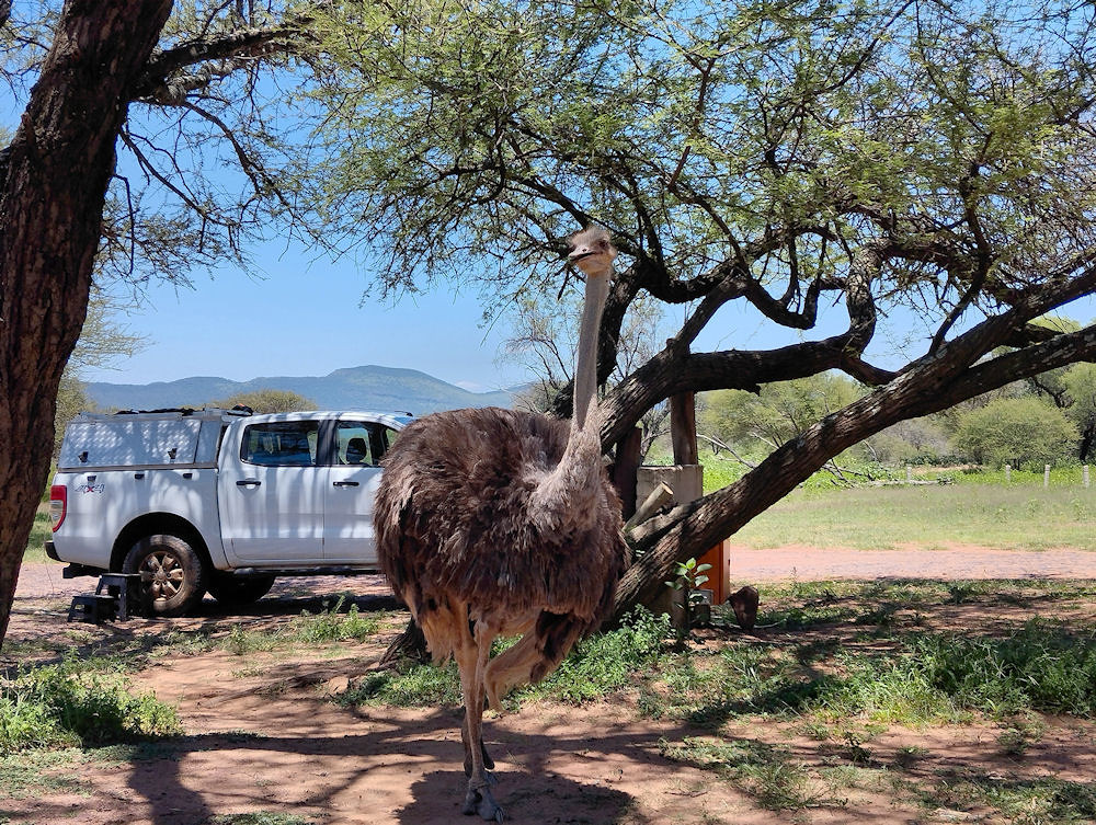
The female ostrich checking if we were offering anything
Contrary to the park's blurb, on our last night, I heard a hyena whooping very close to the campground (it may even have been in the campground). The zebras grazing outside our tent did not seem too perturbed as they carried on grazing.
In spite of being close to both the Rooiberg and Alma Roads, traffic noise was not an issue while we were in the reserve.
(updated: 21 February 2025)
Things to do
As mentioned earlier, the reserve is split into two, with the western part having no dangerous game. The western part is criss-crossed with very overgrown cycle paths - I am not sure how this works as were told at reception that we had to remain in the vehicle when outside the designated "safe" areas. Is someone on a bicycle safer than someone on foot?
There are some roads available for visitors to use for game viewing. These are all gravel, except for the road from the Bakker's Pass gate (this gate is not accessible to visitors) to the Lenong viewsite in the eastern part of the reserve. During our stay, most of the gravel roads were not in a very good condition.
The maps available from SANParks (Map 1b above, Maps 3a and 3b below) are not too useful. The road names on these maps do not correspond very well to the names on the signposts in the reserve. The signposts in the reserve are also lacking in not pointing to important features such as the bird hide.
The map on the Tracks 4 Africa website is probably the best available, even though some of the locations on the map are not correct. You need to zoom in to see a more detailed view of the roads.
I would recommend using a GPS (dedicated or phone app) while travelling in the reserve.
Western section
For me the western section was far better for game drives than the eastern section. Even though the bush was pretty thick, we did see far more game.
Map 3a The western section
The bird hide was worth the visit even though we didn't see any birds!
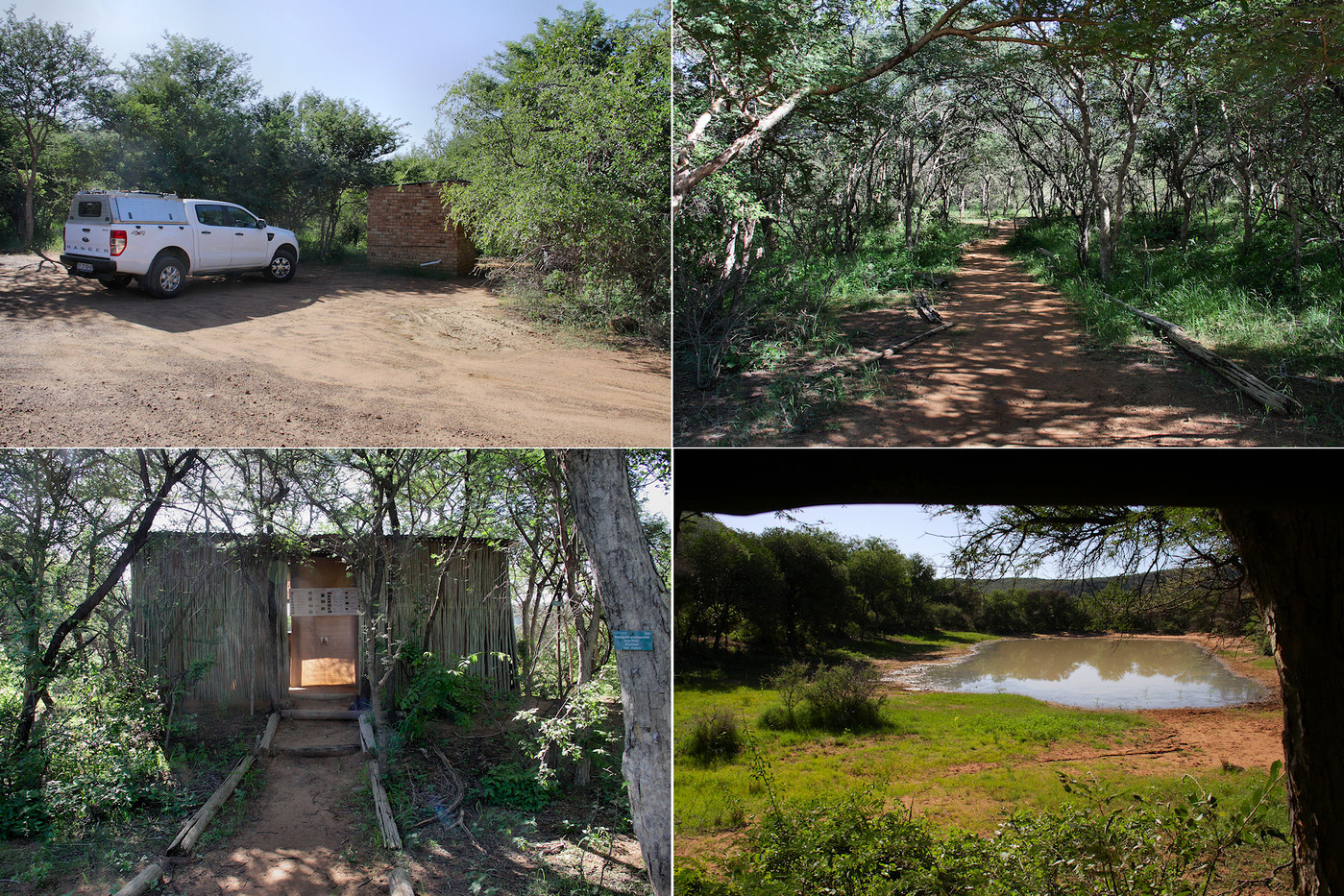
Some pics taken in the vicinity of the hide
Clockwise from top left: the parking area (and toilet); the path to the hide; a view of the dam at the hide; and the hide. We were fortunate to have a nyala come for a drink while we were there, and watching him giving himself a facial was very amusing.
 A nyala giving himself a facial
There is a picnic site in the western section which looks extremely pleasant, with plenty of large shady trees. Strangely enough, there are quite a few tables, but we only saw two braai stands.
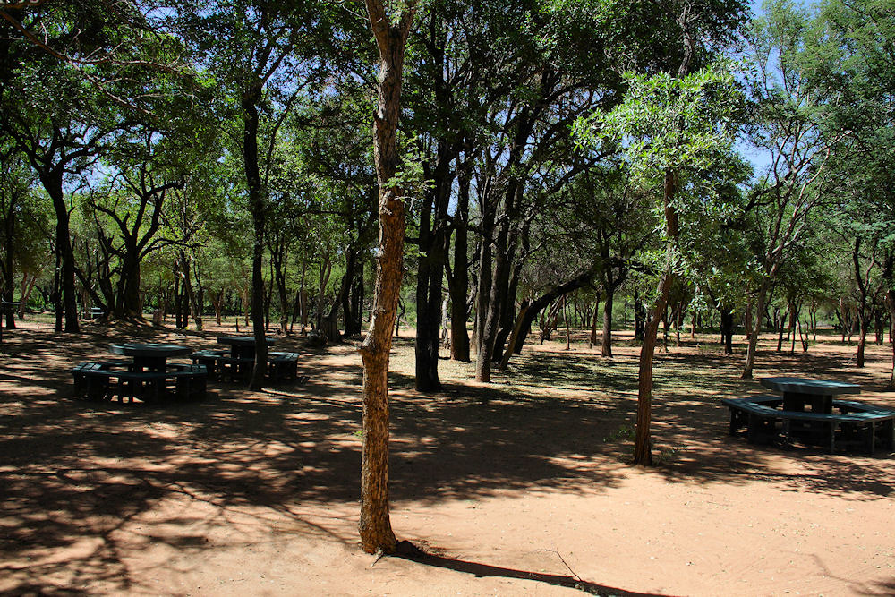
The Tsessebe picnic site
Ironically, the toilet facilities in the picnic site were in far better condition than those in Bontle Camp.
Eastern section
The eastern section does not have too many roads accessible to the public. Although this is the Big 5 section, the main attraction is the drive to the top of Lenong mountain. As we did the mountain view back in 2010, I had no intention of driving up that pass again - the single lane with a sheer drop on the one side is enough to frighten anyone (I developed a fear of heights after our trip over Van Zyl's Pass in 1993).
Map 3b: The eastern section
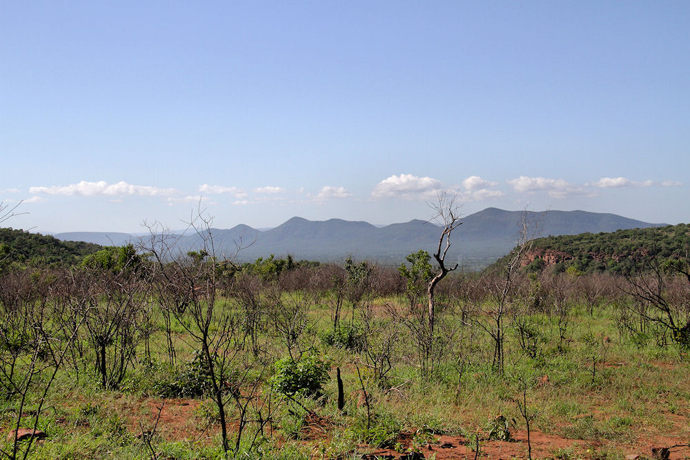
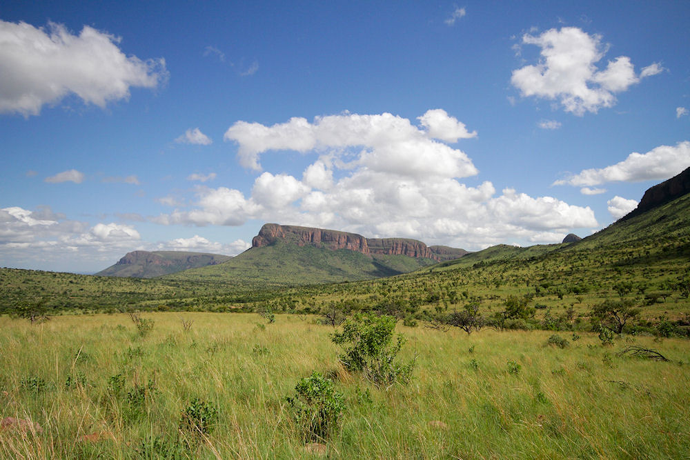
In spite of the lack of roads, the scenery is stunning.
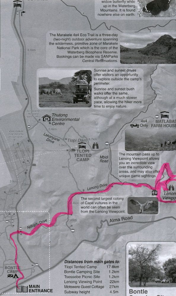
A view of the Waterberg
The gravel road from the gate separating the east and west sections, to the tarred road was badly corrugated. Once on the tar you start driving through the scenery I mentioned earlier.
Some views of the mountains
It was extremely difficult to get the exposure right when taking pics towards the east. As a result some really interesting pics had to be discarded. Even the pics above (taken to the west) were tricky to compose because of the vegetation next to the road.
The Mbidi Road is now mainly 4x4 only due to some very bad wash aways. It's not very difficult to traverse if you take it slowly and switch to low range where necesary. The 4x4 track to Matlabas Zyn Kloof marked on map 3b above is now closed to the public.
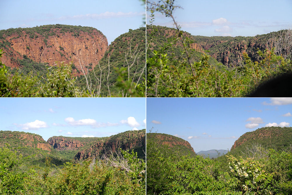
A view over the plains just before the pass up Lenong
We saw very few birds in the eastern section, and the only animals that we saw were zebra, kudu and a Slender Mongoose.
Considering that it was summer, our bird list was surprisingly small. We only managed to ID 61 species and most of these were in the campground. One nice sighting was that of a Bearded Woodpecker, a species we have not seen for a while. Another was a pair of Redbilled Woodhoopoes feeding a recently fledged chick. The chick refused to move more than 20m away from the nest, even when the flock arrived to try and coax it to join the group.
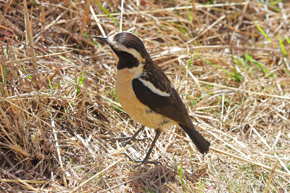
A Buffstreaked Chat on top of Lenong (taken in 2010)
The mobile data signal for both Vodacom and MTN was pretty good with both on 4G (unfortunately, I did not have a 5G SIM to test whether this technology was available in the area).
(updated: 22 March 2025)
Concluding Remarks
Marakele is quite a distance from Pretoria, and the roads, once you leave the N1, are not in a good condition. Currently, Google gives a travelling time of almost 4 hours to cover the 260km to the park.
Like all government funded entities in South Africa, maintenance is not very high on the list of priorities for the funds available. As a result, most of the infrastructure, apart from reception, is rather run-down.
There are not too many roads to travel on in the park and game spotting is made rather difficult by the thick bush and undergrowth.
Would I go to Marakele again? I don't think so. There is not enough to do in this reserve. If hiking was allowed in the western section, that might make me change my mind.
(updated: 19 March 2025)
Equipment tested
We were going to test our homemade bakkie awning on this trip, but had enough shade not to warrant putting it up.
(updated: 18 March 2025)
